Tip 1: How to determine the length of the mainland in kilometers
Tip 1: How to determine the length of the mainland in kilometers
An interesting question of geography is the definition of the real distance between the points indicated on the map. But today it is possible, having in hand only a map or globe, to learn Extension whole mainland at kilometers.
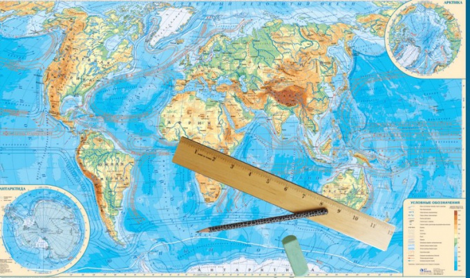
You will need
- - a map of the hemispheres or globe;
- - ruler;
- - calculator.
Instructions
1
In order to know the length mainland From north to south, find the most northern point mainland - the one that is located above all others. Look at the latitude of this point using parallels (horizontal lines), drawn on any map of the hemispheres. To determine the coordinates more accurately, use the electronic map.
2
Similarly, find the southernmost point andcalculate the number of degrees between the southernmost and the most northern point. For example, the southernmost point of Africa is at a latitude of 34º21 'S, and the most northern point is at a latitude of 37º20'N. Since the points are located in different hemispheres, their values add up. As a result, Extension Africa from north to south is equal to 71º41 '(in degrees).
3
To find Extension mainland from north to south in kilometers, multiply the received number of degrees by 111 km (exactly the same number of kilometers in one degree along the meridian). Thus, the length of Africa will be 7930 km.
4
Similarly, determine the length mainland from east to west - first degrees, then in kilometers. The only difference is that if the meridians are the same in length, then the parallels are all different, so the length of one degree for each of them is different. To calculate the length mainland, it is necessary to take into account the angle indicated by the figureOn the parallel line. So, to calculate the number of kilometers in the mainland from west to east, multiply the magnitude of the equator (111.3 km) by the cosine of the angle of the parallel you want, then multiply the result by the length mainland in degrees.
5
To find Extension mainland it is possible and for a certain parallel or for a certain meridian. To do this, find the desired line of the grid and its intersection with the boundary mainland. Then, just as in the first case, calculate the difference between the extreme points and multiply by the number of kilometers in one degree.
6
You can do it and it's easier: just measure length mainland ruler and multiply by the scale indicated on the map. Of course, such a result will be very approximate.
Tip 2: How to find the length
When describing the mainland after its name, as a rule, it is a question of its extent. Length important not only for travelers, but also forgeologists, designers, road builders, oil pipelines and gas pipelines. These geographic data are widely used in astronautics, in natural and exact sciences.

You will need
- - hemispheric map;
- - globe.
Instructions
1
To measure the extent of the continent from the north toSouth and from west to east the grid system of coordinates (latitude - longitude) is used, consisting of parallels and meridians - imaginary lines on the Earth's surface, where latitude and longitude are the coordinates determining the position of these points. Parallels and meridians are clearly depicted on globes and geographic maps.
2
To determine the extent of a given continentFrom the north to the south, find on the map the most southerly and the most northerly of its point. Usually they are marked on all geographical maps. The difference between them will correspond to the extent of the continent from north to south. So, for example, if one of the end points is located at 75o north latitude, and opposite to it at 40o of the same latitude, then the difference is easy to calculate - 35o. A similar method is used to determine the extent from west to east.
3
Then proceed to the calculations. Length measured in kilometers. The meridians are of the same length, and each degree corresponds to approximately 111 kilometers. The remaining number of degrees is multiplied by 111, and you get the desired result - the length of the continent from north to south.
4
A slightly different picture with parallels, becausethey all differ from each other in length. The longest parallel is the equator - 40075.7 km. Parallel to the north and south of the equator, called the northern and southern latitudes. The distance between neighboring parallels, differing by 10 is approximately 111.11 kilometers. On maps and globes, the distance between neighboring latitudes is usually 150 or 1666 kilometers. To determine the desired value, multiply it by the number of degrees that were previously obtained in the calculation. For example, we measure the length of the meridian from the North Pole to the equator. Since the length of the arc of the meridian is 900, then multiply by 111 kilometers by 900. It turns out to be 9,900 kilometers.
Tip 3: How to determine the extent of Africa
In the lessons of geography, it is necessary to translate the visual data of the map into a strict language of figures using improvised means. Identify Extension any geographical object, includingAfrican continent, there are several ways. But none of them will give a hundred percent correct result. The error is about one hundred kilometers.
You will need
- A fairly detailed map of a good academic publication, ruler, calculator
Instructions
1
Use the reference material for geography. Encyclopaedic dictionaries and solid publications about this locality, as a rule, contain information about the main parameters of a given geographic object. The information you are interested in is easy to find on the Internet.
2
Take a map or globe and use a ruler or a measuring dial to determine Extension object in centimeters or millimeters. Carefully consider the angles of this card. Most likely in the lower right corner you will find information about the scale (how many kilometers fit in one centimeter of the map). Multiply the result of your number by the specific scale of the map. The resulting figure will be the one we are looking for.
3
The most accurate arithmetic way to determine Extension The mainland is the calculation along the meridians and parallels. Determine the latitude of the northernmost point on the continent at the given longitude (for Africa It is approximately 32o north latitude) and the southernmost point at this same longitude (about 34o south longitude). Add the result and calculate Extension the continent in degrees 32 + 34 = 66o.
4
The total length of the meridian (360o) is 40000 km, Count Extension Of the given geographical object in kilometers athelp proportion. Or use the ready-made formula that one geographical degree is approximately 111 kilometers. The more accurately you determine the latitude of the southern and northern points, the less the error will be in your calculations.
Tip 4: Which continent and why is called the New Light
The New World was originally called the North and SouthAmerica, separating these continents from the Old World: Europe, Asia and Africa. However, as the opening of new territories, this name also spread to Antarctica, Australia and Oceania.

Instructions
1
Arguing about the New World, it is necessary to distinguishThe concept of "part of the world" and "continent". Parts of the world are called continents or their separate parts together with nearby islands. Total allocate six parts of the world: Europe, Asia, Africa, America, Antarctica, Australia and Oceania. The division of land into continents is based on the sign of separation of water from each other. Parts of the world represent a historical and cultural concept. The continent of Eurasia turns off two parts of the world: Europe and Asia, and America, as part of the world, consists of two continents: North America and South America.
2
The name "Old World" denotes continents -Europe, Asia and Africa, known to Europeans until October 12, 1492, when Christopher Columbus reached the island of San Salvador in the Bahamian archipelago. This day is the official date of the discovery of America. Columbus himself believed that he had opened a new path to India. Therefore, new territories began to be called the West Indies, and their indigenous people - Indians. The very phrase "New World" appeared later, as the part of the southern continent discovered by the Portuguese beyond the Atlantic Ocean in 1500-1502 began to be called.
3
Many scientists believe that the term "New World"It was introduced in 1503 by the Florentine navigator Amerigo Vespucci, whose name subsequently received new continents. However, a number of researchers believe that this merit belongs to Pietro Martire d'Angier, an Italian-Spanish historian who, already in 1492, in his letter about the first voyage of Columbus, used this phrase in Latin. In 1516 he published the famous work "De orbe novo ..." ("In the New World ..."), which described the first contacts of Europeans with the indigenous inhabitants of open lands.
4
In 1524, this name was used by the Italiannavigator Giovanni da Verrazzano in his story about sailing along the coast of the current US and Canada. It is interesting that originally the term "New World" denoted predominantly the southern continent and only after 1541, when new lands were called "America," so began to be called the northern mainland.
5
In the era of the Great Geographical Discoveries,Which lasted from the end of the 15th century to the middle of the 17th century, almost all the territories previously unknown to Europeans were discovered and mapped on maps: Australia, Antarctica, numerous islands in the Pacific and Indian Oceans. Subsequently, the concept of "New World" also spread to these lands.